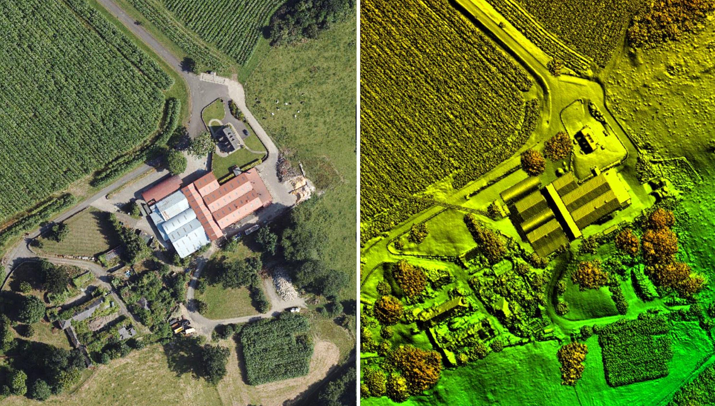
Aerial LiDAR Mapping Benchmarks Carbon Neutral Farming in Northern Ireland
LEICESTERSHIRE, UK / AGILITYPR.NEWS / October 05, 2021 / Bluesky LiDAR Benchmarks Carbon Neutral Farming in Northern Ireland
A European Innovation Partnership project to accelerate the move towards net carbon zero farming is using specially commissioned LiDAR data to create a baseline for future measurements. Working with ARCZero (Accelerating Ruminant Carbon Zero) aerial mapping company Bluesky recorded LiDAR measurements for seven commercial farms across Northern Ireland. This data is being used to calculate above ground carbon storage which will be combined with the results from a whole business Life-Cycle Analysis calculator to inform future farming practices.
“Actual net farm green house gas footprints, at individual farm levels, are not currently known as most methodologies calculate gross footprints for farm enterprises,” commented John Gilliland, Chair of ARCZero Operational Group and partner at Brook Hall Estate, Londonderry. “In addition, on-farm carbon stocks and their potential for carbon sequestration is rarely considered.
“Using the Bluesky LiDAR we can precisely measure stocks such as soils, trees and hedges,” he continued. “This data, when combined with actual carbon inputs and outputs, will allow us to accurately calculate a base-line greenhouse gas position for each farm. Having assessed the current position, we can then prioritise future management practices whilst also making each business more economically resilient. Once finalised, we will share our experiences to help other farms accelerate their move to net carbon zero farming.”
Each farm is supplying input and output data at the start and the end of project which will be analysed using the AgReCalc carbon footprint tool. The farms will also undertake soil analysis to measure carbon content and bulk density. The Bluesky LiDAR data is being processed by researchers at the Agri-Food and Biosciences Institute, using ArcGIS, to locate and measure above ground carbon storage.
The LiDAR data is also being used by Rachel Cassidy of the Agri-Food and Biosciences Institute (AFBI) to identify potential routes of overland water flow, including rainfall, that may impact the volume of soil present and the nutrients contained. This information will also be considered in terms of potential pollution incidents.
All results will be entered to the AgReCalc calculator to determine overall gross farm emissions. This information will then be added to the carbon stock results to create a net farm carbon balance from which future management practices will be assessed.
ARCZero is a recently formed, farmer led innovation group supported by The European Innovation Partnership (EIP) Scheme which, in Northern Ireland, is jointly funded by the European Agricultural Fund for Rural Development (EAFRD) and the Department of Agriculture, Environment and Rural Affairs (DAERA). Other project partners include Devenish, Queen’s University Belfast, Birnie Consultancy and AgriSearch. Further information can be found on the ARCZero website: arczeroni.org

About Us
Bluesky International is the leading aerial survey and geographic data company in the UK producing and maintaining seamless digital aerial photography and height data on a national scale in both Great Britain and the Republic of Ireland. Bluesky also undertakes bespoke surveys, including LiDAR, for a range of public and private sector clients.
Bluesky International operates a range of aircraft and sensors including three Ultracam Eagle Mark 3s, two CityMappers which allow the simultaneous collection of vertical and oblique imagery as well as LiDAR data, and a Galaxy LiDAR which is mounted with a thermal sensor and survey grade camera. These systems put Bluesky International in the enviable position of being able to provide customers with unique and cost-effective geospatial solutions.
As well as being an established and respected aerial survey company Bluesky International is also highly innovative and continually strives to develop new products and services by embracing new technology and methods. This has resulted in the development of some unique products such as the National Tree Map (NTM).
These datasets underpin long term contracts with local and central governments and many major blue-chip companies from a range of market sectors including financial services, utilities, telecoms, web portals, construction and environment. Bluesky International has offices in the UK, US, Republic of Ireland and a dedicated production centre in India.
Contacts